Follow ISR and surveillance drone coverage across Africa — reconnaissance UAVs, border monitoring and intelligence-gathering platforms in military use.
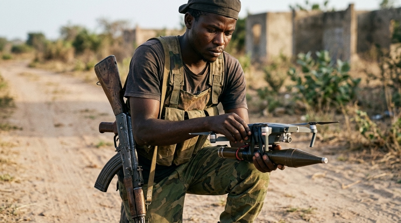
Before Boko Haram’s imitators picked up armed quadcopters in the Sahel, before Somalia’s al-Shabaab turned reconnaissance drones into planning tools, and years before anyone in Nigeria’s northeast strapped a grenade to a commercial airframe, a lesser-known jihadist insurgency in northern Mozambique was already flying drones over its own battlefield. In May 2020, fighters from Ahlu-Sunnah wal Jama’a (ASWJ), the Islamic State’s affiliate in Mozambique, used a drone to identify security force positions ahead of their assault on the coastal town of Mocímboa da Praia, according to Africa Defense Forum and corroborated separately by Military Africa and a Small Wars Journal terrorism research note from Arizona State University. It is one of the earliest confirmed cases anywhere on the continent of a non-state armed group using unmanned aircraft in combat, and it remains the reference point analysts return to when explaining how a tactic once considered exotic became, within a few years, routine.
The insurgency itself predates the drones by three years. Fighters calling themselves Ansar al-Sunna, known locally and confusingly as “al-Shabaab” despite having no connection to the Somali group of the same name, launched their first attacks on police stations in Mocímboa da Praia on 5 October 2017. The group’s grievances trace to Cabo Delgado’s transformation, almost overnight, into one of the most resource-rich corners of Africa: the discovery of massive offshore natural gas reserves and ruby deposits drew billions in foreign investment while doing little for a young, largely excluded local population, a combination that gave Islamist recruiters fertile ground. By the time drones entered the picture in 2020, the insurgency, which the Islamic State now designates its Central Africa Province, had already killed hundreds and was launching more than 20 attacks a month across nine districts, according to the Tony Blair Institute for Global Change.
The Mocímboa da Praia drone sighting was not an isolated data point. Ten months later, during the insurgency’s most consequential single attack, the March 2021 assault on Palma that killed dozens and displaced thousands, ASWJ fighters again used drones for reconnaissance to guide fighters toward government and foreign business targets, according to Military Africa’s tracking of the incident, which also noted unverified private-security reports of small drones monitoring maritime movements offshore, a detail that, if accurate, would predate by several years the debate this site has covered over whether African insurgents might eventually adapt aerial drone tactics to naval ones. Mozambique’s own government confirmed the broader pattern on the record: then-Interior Minister Amade Miquidade told reporters that unmanned aircraft had been deployed by militant groups in Cabo Delgado, a rare instance of a state directly acknowledging the threat rather than leaving it to open-source analysts to piece together, according to the Africa Center for Strategic Studies.
What ASWJ notably did not do, and still has not done, is weaponise any of it. Every documented instance from Cabo Delgado involves surveillance and target identification, never a drone carrying an explosive payload. Analysts Keaton Bunker and John Sullivan, writing in Small Wars Journal, offered a straightforward explanation that has held up well: a reconnaissance drone can be flown again and again as long as it survives, while a drone converted into a one-way weapon is destroyed the moment it succeeds, a poor trade for a group with limited access to replacement hardware. That logic made sense in 2020, when commercial drones were harder to source and less disposable than they are today. What is more striking is that it still appears to hold five years later. Unlike Nigeria’s ISWAP, Somalia’s al-Shabaab, or the Sahelian groups this site has covered extensively, Cabo Delgado’s insurgents have not been reported adopting armed drones even as the tactic spread and cheapened everywhere else on the continent, making Mozambique simultaneously the origin point of the trend and, so far, an outlier in how little that trend has advanced there since.
Cabo Delgado’s significance in the literature is less about what happened next locally and more about what it signalled elsewhere. Multiple analyses frame the sequence explicitly: Boko Haram had already been experimenting with drones in Nigeria before 2020, and Ansar al-Sunna’s adoption of the tactic in Cabo Delgado that year, alongside similar early moves by Somalia’s al-Shabaab, marked the point at which drone reconnaissance stopped being a single group’s innovation and became a technique other insurgencies across the continent recognised and copied. Analysts writing years later, when covering ISWAP’s armed drone attacks in the Lake Chad Basin or the FLA’s fiber-optic FPVs in Mali, routinely cite Cabo Delgado’s 2020 incidents as the earliest well-documented marker in that longer trajectory, the “before” picture against which today’s far more sophisticated and lethal insurgent drone use gets measured.
The wider conflict, meanwhile, has not gone away, even if it has largely gone quiet in international coverage. TotalEnergies’ $20 billion liquefied natural gas project at Afungi, suspended under force majeure after the Palma attack, only announced its intention to resume in November 2025, with production now targeted for 2029, five years later than originally planned. Rwanda’s military deployment, which began with roughly 1,000 troops in July 2021 and has since grown to more than 4,000, has been credited with retaking Mocímboa da Praia and securing the gas project’s perimeter, though the European Union ended its funding for the mission in 2026 over concerns tied to Rwanda’s separate, far more controversial military role backing M23 rebels in the Democratic Republic of Congo, a conflict this site has covered directly. Mozambique says it has secured alternative funding to keep Rwandan forces in place regardless. A regional security monitor’s assessment from early 2026 captured the current state of play bluntly: the persistence of violence in Cabo Delgado reflects not a resurgent insurgency so much as a failure to fully consolidate the military gains made since 2021, with Islamic State-linked fighters still entrenched in the Catupa forest and still capable of striking government positions there, four years after being pushed out of the towns they once held.
Nothing about Cabo Delgado today generates the same volume of coverage as Sudan’s shootdown exchanges or Mali’s FPV campaign, and that is precisely the point analysts keep returning to it for. It is the case that proved the concept, then largely stopped evolving, while everywhere else on the continent kept going. Understanding where the story started is part of understanding how far, and how fast, it has since moved on without it.
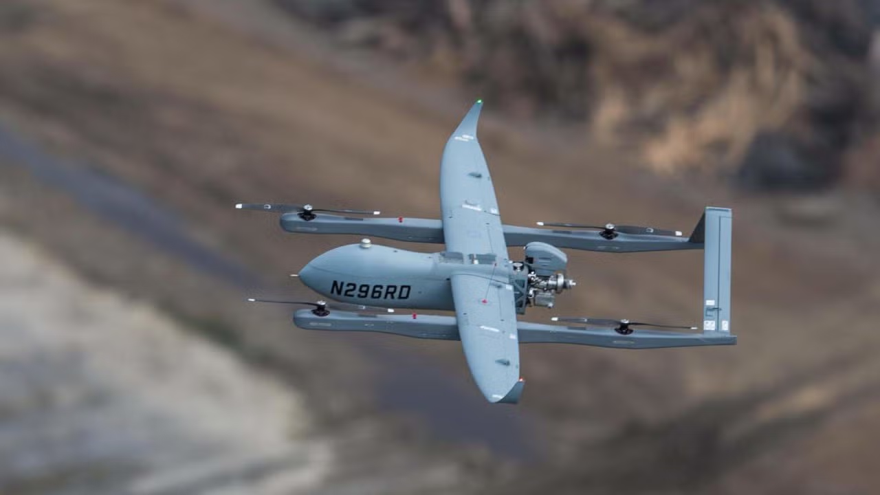
American defence manufacturer Textron Systems Corporation, a subsidiary of Textron Inc. (NYSE: TXT), has been awarded a contract to deliver three Aerosonde Mk. 4.7 vertical takeoff and landing (VTOL) uncrewed aircraft systems (UAS) to Tantita Security Services Nigeria Limited (TSSNL), the private security firm that holds the federal government’s pipeline surveillance contract across the Niger Delta’s oil-producing communities. Textron announced the deal in a statement dated December 29, 2025, saying the aircraft will be delivered in a configuration free of restrictions under the US International Traffic in Arms Regulations (ITAR), the export-control regime that normally limits how far American defence technology can travel once it leaves the United States.
The Mk. 4.7 VTOL differs from the fixed-wing Aerosonde variant Nigeria has operated since 2022 in one important respect: it needs no runway. The aircraft uses what Textron calls Hybrid Quadrotor technology, four rotors that lift the airframe vertically before it pitches into forward flight and cruises on its wings for the bulk of a mission. For an operator working the Niger Delta’s creeks and mangrove swamps, where a conventional airstrip is rarely close to the pipelines and flow stations that need watching, that detail matters more than it would in open terrain. Textron’s own specification sheet for the Mk. 4.7 VTOL lists a range of 140 kilometres on electronic line of sight, up to twelve hours of endurance, a ceiling of 12,000 feet density altitude, and a payload capacity of roughly 20 pounds (about 9 kilograms), enough to carry up to six sensors per sortie from a catalogue of more than 40 payload options that includes full-motion video and signals intelligence packages. The system can reportedly move from transport case to flight in under 20 minutes with a crew of three, and both the airframe and its cases are built for a two-person lift, features suited to operators working from small boats or improvised forward sites rather than fixed bases.
Textron’s own account of the deal credits the award to Arco Worldwide Services (AWS), a Lagos-based drone operator and a subsidiary of Arco Group Plc, an indigenous oil and gas services company with roughly 45 years of operating history in Nigeria. AWS, which describes itself as the country’s first licensed commercial drone operator, will provide the contracted UAS services in support of Tantita’s operations. That role is not new for the firm: Arco Worldwide’s own published account of its work states that it previously facilitated Textron’s earlier Foreign Military Sale (FMS) contract for Nigeria, a $25.6 million agreement signed in 2020 that delivered three fixed-wing Aerosonde 4.7 aircraft to the Nigerian Army, reaching operational status in October 2022 after delays pushed the original 2021 completion date back about a year.
David Phillips, Textron’s Senior Vice President of Air, Land and Sea Systems, called the new aircraft “a mature, highly reliable, and industry-proven autonomous solution” for Tantita’s work. He added that the Aerosonde’s record positions it to help Tantita expand its capacity to protect infrastructure that matters to both domestic security and government revenue. Textron points to the wider Aerosonde family as evidence for that claim: the platform has logged more than 700,000 flight hours across desert, maritime, Arctic and jungle conditions, and it currently flies from more than ten US Navy ships as part of shipboard intelligence, surveillance and reconnaissance (ISR) work.
For Tantita, the acquisition builds on a two-decade-old company and an increasingly technology-heavy operating model. TSSNL was founded in 2005 by High Chief Government Ekpemupolo, widely known as Tompolo, together with engineer Kestin Pondi and two other partners. Tompolo, a former Niger Delta militant leader, serves as a director and remains the company’s most recognisable public figure, while High Chief (Engr.) Kestin Pondi has run day-to-day operations as Managing Director since the firm’s founding.
Pondi has described Tantita’s approach as delivering security solutions tailored to each client, whether government agencies, corporate operators or economies working in high-risk conditions, language consistent with a company that has spent the past year expanding its own technology stack. That stack now includes the Tantita Operations Command and Control Application (TOCA), an in-house platform the company unveiled publicly at Nigeria Oil and Gas Week in Abuja this August, which fuses real-time and historical satellite imagery and lets operators reconstruct vessel movements across Nigerian waters over a two-year window from Tantita’s Command and Control Centres. The new Aerosonde aircraft will feed that system directly, adding a dedicated aerial layer to surveillance work that, in one recent example, saw Tantita intercept a vessel allegedly carrying stolen crude off Delta State in mid-December 2025 and hand the suspects to a federal task force days later.
Independent data offers some support for Tantita’s claims of operational effect, though the picture is not without dispute. A NUPRC-sourced figure reported by Vanguard in September 2025 put average daily crude oil losses at around 9,600 barrels as of July 2025, down from about 102,900 barrels in 2021, a decline of more than 94 percent over the period Tantita has held its surveillance mandate. At the same time, the company’s effective hold on pipeline protection in the region has drawn criticism from Niger Delta civil society groups, who in a March 2026 open letter questioned both the cost of the contract and Tantita’s ability to reach remote swamp terrain.
Textron had not published a delivery timeline for the three aircraft as of late August 2026. In early January, Tantita’s Executive Director of Operations and Technical said company personnel had already travelled to the United States to inspect Aerosonde operations and study the technical processes involved, describing Tantita as the first private security firm in Nigeria to acquire an Aerosonde platform with full ISR capability. The contract also carries options for additional aircraft and further training as Tantita’s needs grow, a structure that lets a customer scale a fleet in stages rather than commit to a large purchase upfront.
The sale places Nigeria among a small but expanding group of countries where Western-built VTOL drones are entering service with private security operators rather than state militaries, a shift likely to draw as much scrutiny as interest across a West African security market where oil theft, pipeline sabotage and maritime crime remain persistent threats to national revenue.
The arid, sun-baked expanses of northern and central Mali have transformed into an operational proving ground for specialized uncrewed aerial systems originating from Eastern European military inventories.
Following the reorganization of Russian private security elements into the official Africa Corps under the authority of the Russian Ministry of Defence, military operations alongside the Armed Forces of Mali, known locally as the Forces Armées Maliennes, have taken on a distinctly high-technology character.
Facing decentralized non-state armed groups, including Jama’at Nasr al-Islam wal-Muslimin and the separatist movement known as the Azawad Liberation Front, pro-government formations have deployed precision loitering munitions, long-range attack drones, and persistent reconnaissance aircraft into an operational environment characterized by severe heat, blowing sand, and immense geography. This technical escalation represents a notable evolution in Sahelian counter-insurgency warfare, where traditional motorized patrols face continuous risks from roadside ambushes and concealed explosive devices.
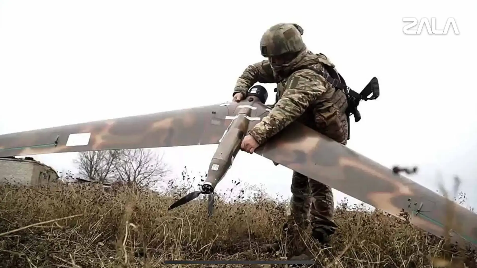
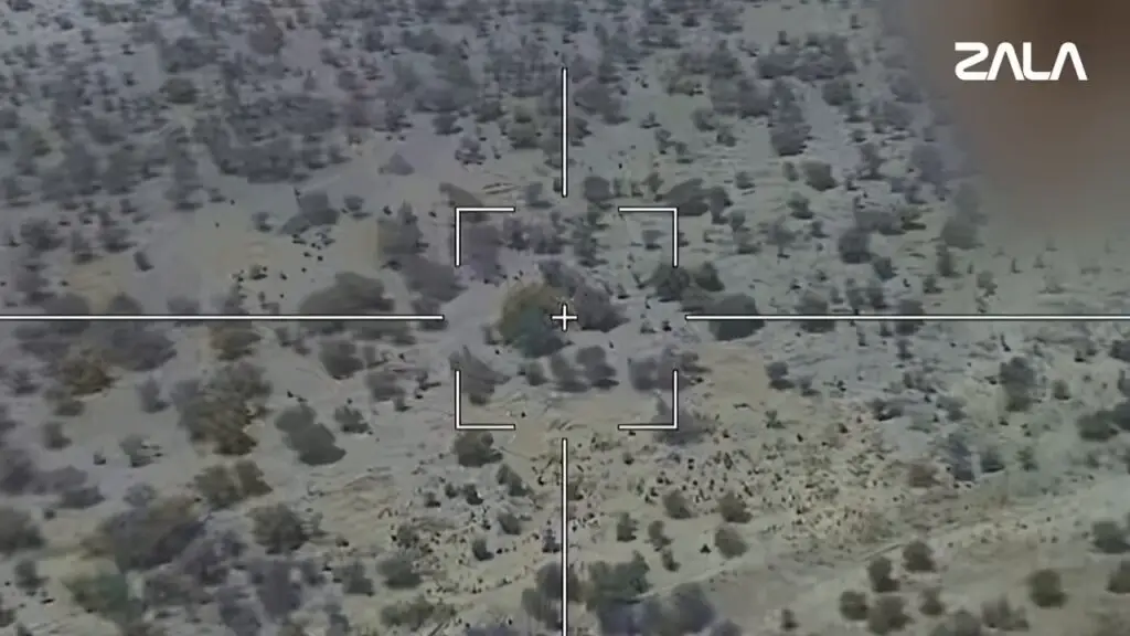
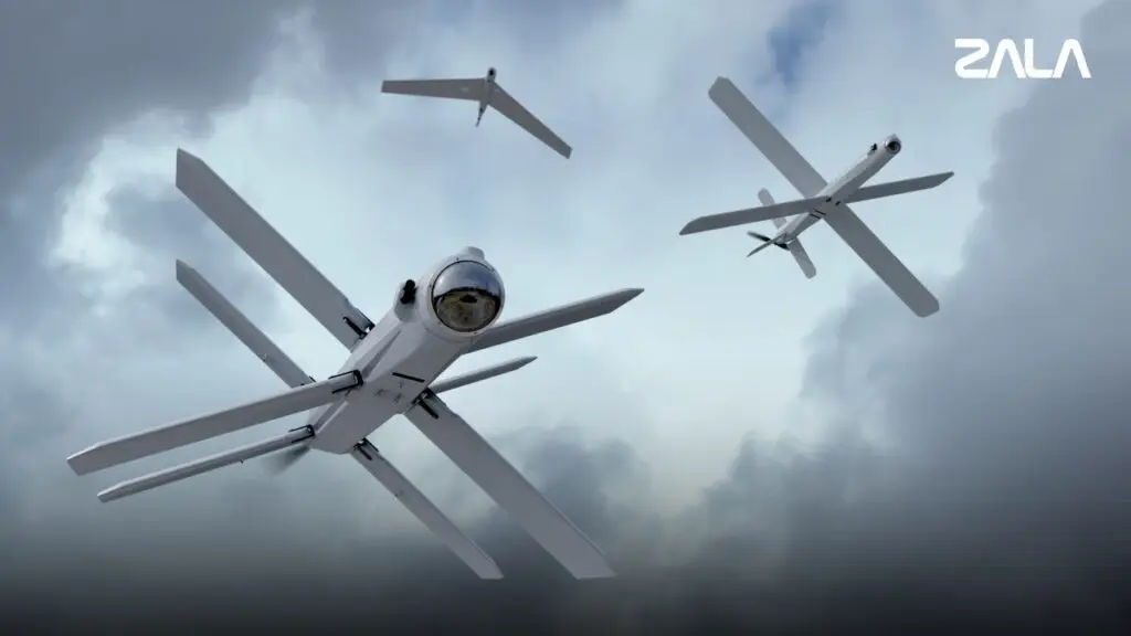
During an aerial reconnaissance mission using a ZALA Z-16 UAV, units of the ZALA «Lancet» Combat Group of the Russian Ministry of Defence’s African Corps detected a camouflaged fuel and lubricants depot being used by terrorists.
Examining ZALA Lancet and Reconnaissance Drone Operations in Mali
The shift toward uncrewed aerial platforms reflects a growing tactical imperative across the Sahelian theater. Ground forces operating in regions such as Mopti, Timbuktu, Kidal, and Sévaré must monitor hundreds of kilometers of unpaved supply corridors and remote desert hideouts. Traditional manned air assets, such as light attack helicopters or transport aircraft, incur substantial operational costs, require intensive maintenance, and expose aircrews to ground-based small arms fire. By deploying an integrated network of surveillance and strike drones, commanders seek to establish continuous overhead observation, compress the kill chain between target detection and engagement, and project kinetic force without risking pilot lives. However, transferring military hardware designed for temperate European battlefields into the hyper-arid climate of West Africa introduces complex engineering and tactical trade-offs that reshape how these systems perform in practice.
                          +-------------------------------+
                          |    ZALA Z-16 Reconnaissance   |
                          |  - EO/IR Sensor & Thermal     |
                          |  - Signal Relay Node          |
                          +---------------+---------------+
                                          |
                                   Target Acquisition
                                          |
                                          v
                          +-------------------------------+
                          |  ZALA Lancet Strike Munition  |
                          |  - Real-time TV Guidance      |
                          |  - IRRA Autonomous Matching   |
                          +-------------------------------+
The core of this new tactical framework rests upon a combined reconnaissance and strike complex built by ZALA Aero Group, an uncrewed systems subsidiary of Russia’s Kalashnikov Concern. The system pairs the ZALA Z-16 reconnaissance Unmanned Aerial Vehicle with the ZALA Lancet loitering munition. Within this operational pairing, the Z-16 acts as the primary sensory node. Featuring a flying-wing design with a wingspan of approximately 3.1 meters and a maximum takeoff weight of 12 kilograms, the electric-powered aircraft provides all-weather aerial monitoring. Launched via a pneumatic catapult and recovered by a belly-landing parachute system, the Z-16 carries an interchangeable gyro-stabilized payload combining high-resolution electro-optical cameras, forward-looking infrared thermal sensors, and laser rangefinders. Operating at altitudes between 1,000 and 3,000 meters above ground level, the platform detects troop movements, concealed vehicle parks, and temporary staging encampments across day and night operational cycles.
Beyond target detection, the Z-16 fulfills a vital communications role as an airborne signal repeater. In the flat, featureless desert terrain of northern Mali, ground-based radio signals quickly degrade due to line-of-sight obstacles and curvature over long distances. The Z-16 orbits at high altitude to relay control data and real-time video telemetry between ground control stations and strike weapons. This capability allows operators to deploy the ZALA Lancet loitering munition near the maximum boundary of its flight envelope.
When the Z-16 identifies a tactical target, such as a armed pickup truck or a concealed fuel depot, operators launch the Lancet. The Lancet features a distinctive double-X cruciform wing arrangement that provides high maneuverability during dynamic terminal dive phases. Powered by an electric motor driving a rear pusher propeller, the weapon achieves cruising speeds between 80 and 110 kilometers per hour, with acceleration reaching nearly 300 kilometers per hour when diving toward a target. The platform has a maximum takeoff weight of 12 kilograms, carries a high-explosive fragmentation or shaped-charge warhead weighing between 3 and 5 kilograms, and maintains an operational engagement range up to 40 kilometers.
ZALA drones
Operators guide the Lancet using a continuous television communications link, viewing live optical feed from the drone’s nose camera. This human-in-the-loop guidance architecture enables precise target selection right up to the moment of detonation. If non-combatants enter the target area or if a target moves behind impenetrable cover, the operator can abort the strike, re-navigate the munition, or loiter in the target area for up to 40 minutes. Recent combat data verified as of August 2026 confirms that deployed Lancet units in Mali incorporate the Intelligent Targeting and Recognition System, an automated image-matching software suite. This system analyzes real-time video feeds against pre-loaded object libraries, helping operators pick out camouflaged vehicles and structures against the glare of sand and scrubland.
In July and August 2026, official communications from the Africa Corps and regional field reports confirmed multiple Lancet strikes across northern Mali. In one reported engagement near Timbuktu, a Z-16 reconnaissance drone spotted a pickup truck operated by insurgent fighters monitoring a government military installation. The crew launched a Lancet, which struck the target directly, while the Z-16 remained overhead to record video confirmation of the destroyed vehicle. Subsequent strikes targeted hidden fuel caches, logistics nodes, and isolated command posts. The combination of real-time aerial identification and rapid kinetic response severely restricts the mobility of non-state groups, forcing them to abandon large motorized convoys in favor of smaller, dispersed formations.
Despite these tactical successes, operating the Lancet and Z-16 complex in the West African desert presents severe environmental challenges. Systems engineered primarily for European climates face extreme mechanical stress when subjected to ambient temperatures exceeding 45 degrees Celsius in the Malian sun. Thermal battery management is an immediate engineering vulnerability. Lithium-polymer batteries power both the Z-16 airframe and the Lancet’s electric propulsion motor. High ambient temperatures accelerate internal chemical degradation, reduce total battery cycle life, and cause thermal inflation. Operating under peak afternoon heat can diminish total loiter endurance by 15 to 25 percent compared to standard factory specifications.
Fine windborne dust and abrasive silica particles present another operational hazard. During the seasonal Harmattan, fine sand fills the lower atmosphere, entering unsealed electronic bays, clogging cooling channels, and abrading the optical surfaces of electro-optical and thermal cameras. Dust accumulation on optical lenses degrades image clarity, reducing the effectiveness of automated target recognition software like the Intelligent Targeting and Recognition System. To maintain operational capability, ground maintenance crews must implement strict field protocols, including airframe joint sealing, frequent lens cleaning using specialized optical solvents, and climate-controlled storage containers for sensitive guidance components. Furthermore, optical tracking software requires continuous recalibration to handle the intense light reflection generated by desert soil, which differs sharply from the darker, vegetation-heavy backgrounds of Eastern European battlefields.
Tactical Implications of Russian UAV Deployments in Mali
The tactical adaptation in Mali extends beyond short-range loitering munitions to include long-range strategic attack platforms. In mid-May 2026, wreckage recovered by local fighters near the central town of Sévaré revealed debris from a Garpiya-A1 long-range strike drone. Technical analysis of the recovered fragments confirmed that the downed airframe belonged to the specialized KK-series variant, which incorporates an air-burst warhead designed to detonate above ground level to maximize antipersonnel and light-vehicle fragmentation effects.
The Garpiya-A1 is a strategic attack drone manufactured in Russia by IEMZ Kupol, a subsidiary of Almaz-Antey. The design incorporates Chinese-produced Limbach L550E four-cylinder gasoline engines, commercial off-the-shelf microelectronics, and a delta-wing airframe closely resembling the Iranian-designed Shahed-136. With a wingspan of 2.5 meters, a launch weight exceeding 200 kilograms, and an operational range reaching up to 1,500 kilometers, the Garpiya-A1 carries a 50-kilogram explosive warhead. In the Ukrainian theater, Russian forces launch these platforms in multi-drone waves against fixed strategic infrastructure using pre-programmed satellite navigation coordinates.
The discovery of Garpiya-A1 wreckage near Sévaré marks the first confirmed operational deployment of this platform type in the Sahelian conflict. However, defense analysts from the Royal United Services Institute note that using long-range kamikaze drones in a counter-insurgency environment creates an operational mismatch. Counter-insurgency warfare in West Africa demands flexible real-time targeting against fluid, fast-moving insurgent groups. A long-range drone reliant on static pre-programmed coordinates cannot track or engage mobile tactical targets like motorcycle squads or evasive technical vehicles. Unless directed against fixed insurgent bases, captured military infrastructure, or static fuel storage sites, platforms like the Garpiya-A1 offer limited utility against nimble guerrilla forces. Their presence in Mali indicates a broader strategy by foreign military advisors to deploy available surplus inventory into the African theater, even when the underlying design aligns poorly with tactical counter-insurgency needs.
To fulfill the requirement for long-endurance overhead surveillance and flexible air-to-ground strike capability, pro-government forces in Mali have deployed the Kronshtadt Orion Medium-Altitude Long-Endurance Unmanned Aerial Vehicle. First observed conducting missions over towns such as Kati and strategic sectors across the Gao region in mid-2026, the Orion provides capabilities distinct from tactical loitering munitions and static attack drones.
The Orion features a high-aspect-ratio wing design with a wingspan of 16.3 meters, a maximum takeoff weight of 1,000 kilograms, and a payload capacity of up to 200 kilograms. Powered by a turbocharged internal combustion engine driving a rear pusher propeller, the aircraft achieves cruising speeds of 120 to 200 kilometers per hour, operates at service ceilings up to 7,500 meters, and maintains a continuous flight endurance of 24 hours. The drone carries a gyro-stabilized ventral turret equipped with high-resolution electro-optical cameras, thermal imaging channels, a laser rangefinder, and a laser target designator. It can also mount small synthetic aperture radar pods to track ground movement through thick dust cover or cloud layers. For strike operations, the Orion carries up to four guided munitions, including KAB-20 light aerial bombs and Kornet-derived anti-tank guided missiles.
Sahelian Drone Warfare
The strategic rationale for deploying Orion platforms to West Africa is rooted in air defense dynamics. In Eastern Europe, dense, layered surface-to-air missile networks severely limit the operational utility of large, slow-moving uncrewed platforms. In contrast, the African airspace represents a permissive operating environment. Non-state insurgent groups in the Sahel lack radar-guided air defense systems, possessing only heavy machine guns and shoulder-fired man-portable air defense systems with restricted altitude ceilings. Operating comfortably above 5,000 meters, the Orion flies well beyond the engagement envelope of insurgent weaponry. This allows the platform to perform persistent Intelligence, Surveillance, and Reconnaissance over vital logistics corridors, international border regions, and population centers without facing air defense threats.
However, operational friction persists in air-ground coordination. Operational assessments from July 2026 concerning engagements near Tabrişat in the Gao region revealed instances where pro-government ground convoys suffered heavy casualties from rebel ambushes despite the presence of Orion surveillance platforms in the general theater. Effective air-ground integration requires robust communications infrastructure, trained joint terminal attack controllers embedded with forward infantry units, and streamlined command loops. When foreign technical operators manage aerial assets independently from local ground commanders, critical intelligence often fails to reach tactical units in time to prevent ground ambushes.
The deployment of these uncrewed systems in Mali reflects a broader trend reshaping military capabilities across the African continent. From West Africa to the Horn, sovereign armed forces are acquiring uncrewed aerial platforms to overcome territorial vastness, monitor porous borders, and project airpower against irregular armed threats.
In Nigeria, the armed forces operate an extensive array of uncrewed platforms within the Lake Chad Basin and the northwestern theater. The Nigerian Air Force employs Chinese-manufactured Wing Loong II and CH-4 Medium-Altitude Long-Endurance drones for persistent surveillance and precision strikes against insurgent factions like Islamic State West Africa Province. To counter the growing threat of insurgent commercial drones used for reconnaissance and improvised weapon drops, Nigerian defense contractors have partnered with local research institutions to develop indigenous Counter-Unmanned Aerial Systems. These local counter-drone platforms combine radio-frequency spectrum monitoring, automated camera tracking, and directional radio-frequency jamming shields to secure critical forward operating bases.
In East Africa, the Ethiopian National Defence Force deployed a varied fleet of Turkish Bayraktar TB2, Chinese Wing Loong, and Iranian Mohajer-6 drones during recent domestic operations. These medium-altitude strike platforms proved decisive in disrupting heavy artillery positions and armored vehicle columns across open mountain terrain. Similarly, in North Africa, Libyan factions deployed Turkish Bayraktar TB2s and Chinese-built Wing Loong aircraft extensively, creating one of the most drone-dense combat environments in regional military history.
When compared to these continental developments, the drone framework in Mali presents a unique reliance on foreign private military management through the Africa Corps. While nations like Nigeria, Morocco, and Egypt maintain sovereign control over their drone infrastructure, pilot training programs, and command protocols, defense operations in Mali remain dependent on foreign technical crews for flight control, signal analysis, and field maintenance. This external dependence creates an operational vulnerability. If foreign technical personnel are withdrawn or redeployed due to shifting external priorities, local armed forces risk losing immediate overhead visibility and precision strike support.
The integration of Lancet loitering munitions, Z-16 surveillance platforms, Garpiya-A1 strike drones, and Orion endurance UAVs demonstrates that modern airpower concepts are reshaping Sahelian counter-insurgency warfare. As state forces rely increasingly on uncrewed systems to secure remote territory, non-state armed groups are modifying their field tactics in response. Insurgent formations like Jama’at Nasr al-Islam wal-Muslimin and the Azawad Liberation Front are adapting by avoiding large vehicle concentrations, utilizing thermal camouflage netting, dispersing personnel into small motorcycle teams, and conducting movements during poor weather or night conditions when optical sensors face performance limits.
For African defense planners, the lessons emerging from the Malian conflict demonstrate both the clear advantages and operational boundaries of uncrewed aerial technology. While precision loitering munitions and persistent surveillance platforms provide valuable situational awareness and rapid strike options over vast desert corridors, they cannot independently secure territory. Uncrewed systems serve as effective force multipliers, but achieving lasting stability across the Sahel requires pairing aerial sensor networks with disciplined ground forces, clear command integration, and sustained community engagement strategies.
Force modernization reports across African air force headquarters show a clear trend in aerial procurement. Defense ministries from West Africa to the Horn of Africa are expanding uncrewed aerial vehicle inventories while simultaneously acquiring crewed turboprop surveillance aircraft. In recent operational cycles, air forces in Nigeria, Kenya, and Algeria integrated new Beechcraft King Air 350i and Cessna Grand Caravan EX surveillance planes alongside Class III Medium-Altitude Long-Endurance (MALE) drones such as the Bayraktar TB2 and Wing Loong II. This parallel purchasing strategy addresses a persistent debate among military planners over whether uncrewed systems can fully replace crewed reconnaissance platforms in modern operational theaters.
Field data from active counter-insurgency and maritime domain awareness missions indicates that replacing crewed aircraft with uncrewed systems creates operational gaps. Rather than functioning as mutually exclusive choices, crewed surveillance planes and long-endurance drones address different tactical problems. Building an effective Intelligence, Surveillance, and Reconnaissance (ISR) architecture requires security organizations to deploy both capabilities in an integrated, layered network.
Payload Capacity and Onboard Processing Dynamics
Crewed turboprop surveillance platforms offer payload capacity and real-time processing capabilities that uncrewed platforms struggle to replicate. Aircraft such as the Beechcraft King Air 350i ISR and the ATR-42 Maritime Patrol Aircraft (MPA) feature maximum takeoff weights exceeding 5,000 to 18,000 kilograms. This structural capacity allows them to carry multi-sensor suites weighing several hundred kilograms, including dual Electro-Optical/Infrared (EO/IR) sensor gimbals, maritime search radars, and broad-spectrum Synthetic Aperture Radar (SAR) suites.
Crucially, crewed ISR aircraft carry human intelligence analysts directly inside the cabin. Onboard systems operators process raw sensor imagery, evaluate tactical movements, and communicate actionable targeting data directly to ground commanders or strike aircraft in real time. This onboard processing avoids reliance on high-bandwidth satellite data links, eliminating transmission latency and mitigating vulnerability to ground-based signal interference. In high-density signal environments or remote coastal zones, a crewed platform functions as a mobile Airborne Command and Control (C2) node capable of directing complex joint operations.
Conversely, Class III MALE uncrewed systems operate under stricter weight and power budgets. A Bayraktar TB2 carries a maximum payload of approximately 150 kilograms, while the larger Wing Loong II carries up to 480 kilograms of sensors and weapons. While these systems carry advanced EO/IR gimbals like the L3Harris WESCAM MX-15, they generally stream raw sensor data back to a Ground Control Station (GCS) via Line-Of-Sight (LOS) radio relays or Satellite Communications (SATCOM). In remote sectors where satellite links are unavailable or bandwidth is limited, uncrewed systems cannot transmit full-motion, high-definition video over long distances without data degradation.
Persistence Versus Speed and Weather Resilience
Uncrewed systems hold a clear advantage in operational persistence. The primary operational value of MALE platforms lies in their ability to maintain continuous loiter time over a specific target area. A standard MALE drone can remain airborne for 24 to 30 hours without crew fatigue limits, providing an unblinking eye over known insurgent corridors or fixed infrastructure. Ground commanders rely on this persistence to track pattern-of-life behaviors, monitor remote border sectors, and maintain continuous target designation for ground artillery.
However, crewed surveillance aircraft compensate for shorter flight endurance with superior transit speed and weather resilience. A King Air 350i cruises at speeds above 300 knots (555 kilometers per hour), allowing it to respond rapidly to unexpected distress calls, ambush reports, or maritime security incidents hundreds of kilometers away. By contrast, most MALE drones cruise between 110 and 150 knots, requiring hours to reach distant operational areas.
Atmospheric conditions across tropical and desert regions further illustrate the operational trade-offs between both categories. Severe dust storms during the Harmattan season and heavy equatorial cloud belts frequently obstruct optical sensors on high-altitude drones. To maintain visual contact, drone operators must descend below the cloud base, exposing multi-million-dollar airframes to small arms and light anti-aircraft fire. Crewed surveillance planes equipped with heavy, high-powered SAR suites can penetrate cloud cover and rain, mapping terrain and tracking surface targets from safe operational altitudes.
Strategic Integration Across African Security Theaters
The operational realities of African defense sectors reinforce the necessity of a balanced fleet structure. According to the African drone procurement data, continental defense ministries acquired over 1,000 uncrewed aerial units between 2020 and 2026. Yet, nations facing active counter-insurgency campaigns continue to fund crewed ISR upgrades.
In West Africa, the Nigerian Air Force operates a mixed ISR architecture combining ATR-42 MPA airframes, Beechcraft King Air 350i platforms, and Wing Loong II drones. During joint operations in the Lake Chad Basin, crewed surveillance planes execute wide-area maritime and land radar scans to detect suspicious movements. Once a potential target sector is identified, commanders dispatch loitering MALE drones to maintain continuous target tracking and execute precision strikes. This operational division maximizes the strengths of both platforms while minimizing overall flight-hour costs.
Similarly, in East Africa, Kenya deploys crewed utility turboprops alongside tactical uncrewed assets for border monitoring and wildlife protection. While multirotor and small fixed-wing drones support localized perimeter defense and tactical reconnaissance for infantry patrols, crewed aircraft execute broad maritime patrols along the Indian Ocean coastline. Meanwhile, emerging domestic drone manufacturing initiatives in South Africa, Nigeria, and Algeria aim to build localized airframes that can seamlessly integrate into existing crewed communication networks. Further technical details on regional deployments appear in our analysis of counter-insurgency aerial operations.
Security organizations that attempt to replace crewed surveillance aircraft entirely with uncrewed fleets run major operational risks. Over-reliance on drones creates single-point vulnerabilities to satellite link outages, cyber-interference, and seasonal weather disruptions. Conversely, relying solely on crewed aircraft drives up operating costs and exhausts flight crews during prolonged surveillance missions.
Optimal defense capability stems from deploying the correct platform for each specific operational profile. MALE drones excel at persistent, localized loitering over known target zones. Crewed surveillance aircraft excel at wide-area search, rapid emergency response, heavy sensor processing, and weather-penetrating reconnaissance. Modern security organizations that invest in both platforms as complementary assets establish a resilient, multi-layered aerial defense architecture.
A UAV segment at this year’s Nigerian Army Day Celebration put three very different unmanned aircraft on display side by side — a South African VTOL surveyor, a Chinese unmanned helicopter, and a modified commercial airframe — offering a rare public snapshot of how Nigeria’s ground forces are assembling their drone fleet.
Port Harcourt hosted the 163rd Nigerian Army Day Celebration (NADCEL) from 4 to 6 July 2026, run this year alongside the third Africa Land Forces Forum and drawing Chiefs of Army from across the continent — among them Angola, Cameroon, Ghana, Morocco, South Africa, Tanzania, Uganda and Zimbabwe — plus former Nigerian heads of state Yakubu Gowon and Olusegun Obasanjo. The grand finale at Liberation Stadium on 6 July, presided over by Vice President Kashim Shettima on behalf of President Bola Tinubu, combined a military parade and tactical demonstrations with an equipment and research-and-development exhibition, built around the theme “Protecting the Nation and Serving the People: A Way Forward for the Nigerian Army.”
Much of the coverage to come out of NADCEL 2026 focused on the theatre of the occasion — Army skydivers exiting a C-130 at 12,000 feet, a widely shared helicopter rescue drill involving the Army’s Bell UH-1 Hueys. But for anyone tracking Nigeria’s unmanned systems programme specifically, the more revealing segment of the display was quieter: three distinct UAV types set out together, each representing a different route into the Nigerian Army’s growing drone inventory.
ALTI Transition: long-endurance coverage without a runway
The first aircraft on display was the ALTI Transition, a fixed-wing vertical take-off and landing (VTOL) drone from South African manufacturer ALTI Unmanned. The Transition is what the company calls a “double hybrid” design: electric power lifts it straight up and sets it back down, while a small petrol engine takes over once it’s airborne for level flight. That combination lets it launch and recover from confined spaces without a runway or catapult, while still covering the distances a conventional fixed-wing aircraft can manage. Per the manufacturer’s own published specifications, the Transition has a 3-metre wingspan, a length of 2.3 metres, a maximum take-off weight of around 16 kilograms, and can stay airborne for up to 12 hours depending on configuration — long-duration coverage over a fixed area at a fraction of the cost of a larger platform.
Open-source tracking of Nigerian drone inventories has previously placed the ALTI Transition with the Nigerian Police rather than the Army, so its appearance at NADCEL 2026 points either to a newer Army acquisition or to a joint display drawing on more than one security agency’s equipment. Neither the Army nor ALTI has clarified the point publicly, and it could not be independently confirmed beyond what was shown at the parade.
ALTI Transition long-range drone of the Nigerian Army
Ziyan Blowfish: a helicopter that needs no airstrip
The second type on display, the Ziyan Blowfish, has a longer public history with the Nigerian Army. Military Africa first reported the type in Nigerian Army service in July 2023, when it was shown by the Army’s Command Engineering Depot. Built by Guangdong-based Ziyan UAV, the baseline Blowfish A2 is a small autonomous helicopter with a maximum take-off weight of 38 kilograms, a payload of 12 to 15 kilograms depending on configuration, a cruise speed up to 130 km/h and an operational range of roughly 100 kilometres. Its open-cabin fuselage — unusual among helicopter drones for lacking a conventional enclosed belly — accepts electro-optical and infrared cameras, laser rangefinders, jamming equipment and, in some configurations, mortar bombs or guns, making it a compact intelligence, surveillance and reconnaissance (ISR) and light-strike platform that needs no prepared airstrip to operate.
The Nigerian Army carried out aerial display of the Ziyan Blowfish (Image by Military Africa)
The Blowfish sits inside a wider Army Aviation UAV structure the Nigerian Army set up in 2020, which also includes Textron’s Aerosonde fixed-wing drones and, more recently, Turkish Bayraktar TB2s — a lineup that has expanded considerably since the Blowfish’s 2023 debut. The Army has separately begun work on a $3.2 million aviation hangar at Bola Ahmed Tinubu International Airport in Minna, Niger State, intended to eventually house a dozen MD530 Cayuse Warrior attack helicopters, ten Bayraktar TB2s and roughly eight Magnus MF-212 light attack aircraft — a measure of how far the wider aviation build-up has moved in three years.
Poseidon H6: building military capability on a commercial kit
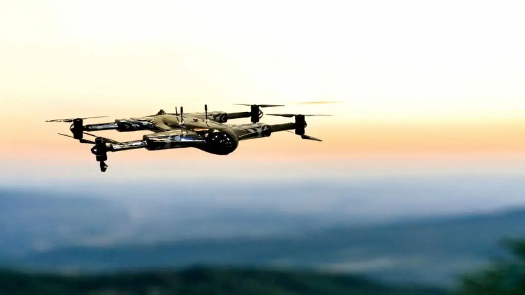
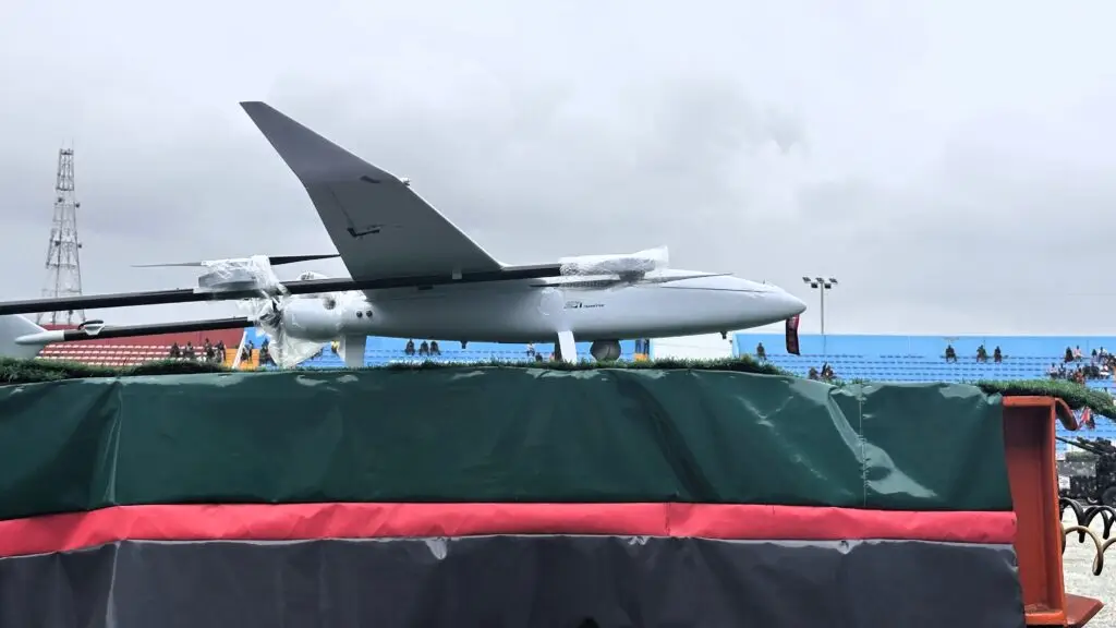
The third airframe shown, described as Poseidon H6 is a “highly modified” Mugin-6 Pro Long Range VTOL platform, reflects a different procurement logic altogether. The Poseidon H6 is a large, military-grade Vertical Take-Off and Landing (VTOL) Unmanned Aerial System (UAS) manufactured by the Cypriot aerospace company Swarmly Ltd. It is primarily engineered for heavy-lift, long-endurance reconnaissance, and tactical operations across both land and maritime environments.
Mugin UAV, based in Hong Kong, sells the Mugin-6 Pro as an airframe kit rather than a finished military system — a 6-metre-wingspan, carbon-fibre VTOL platform built primarily for civil mapping, surveying and inspection work, with the long-range VTOL configuration shown rated for a 25-kilogram payload and up to five hours of endurance in hybrid mode.
What appears to be a Poseidon H6 which is a highly modified Chinese Mugin-6 Pro UAV (Image by Military Africa)
Nigeria already has history with the type, though not previously in a combat role. The Nigerian Air Force has used Mugin commercial airframes for initial UAV pilot training at its 401st Flying Training School in Kaduna, before trainees move on to more advanced platforms. That fits a broader pattern in Nigeria’s home-grown drone development, which has previously produced locally adapted airframes such as the Amebo, Gulma and, most successfully, the Tsaigumi — developed jointly by the Air Force Institute of Technology and Portugal’s UAVision and inducted into service in 2018. Across that programme, Nigeria has consistently favoured adapting inexpensive commercial or semi-commercial airframes for military ISR and strike roles over importing complete foreign weapon systems outright. A “highly modified” Mugin-6 fits squarely into that pattern: a long-endurance, heavy-payload civilian airframe adapted domestically with military sensors and communications equipment, an approach that controls cost while building technical capacity inside the country rather than buying it in from abroad. What modifications were made to the specific airframe shown at NADCEL 2026 were not detailed in available reporting.
A modernisation drive years in the making
Taken individually, none of the three aircraft is new to Nigeria. What the NADCEL 2026 display captured, arguably more usefully, was the range of a strategy already under way: a ready-made VTOL surveyor imported from South Africa; a Chinese combat helicopter already several years into service; and a commercially sourced airframe being adapted in-house. Setting all three out together at the Army’s flagship annual event, alongside a parade, an R&D exhibition and international guests from more than a dozen African armies, reads as a deliberate statement about where the Nigerian Army’s aviation programme is heading — not toward a single supplier or doctrine, but toward a mixed fleet assembled from whichever combination of imported systems and local adaptation gets capability into the field fastest.
That framing lines up with what Nigerian Army leadership has been saying in public this year. Chief of Army Staff Lieutenant General Waidi Shaibu, who took over the role in October 2025, has repeatedly tied the Army’s operational record against insurgents, bandits and armed groups to investment in intelligence and technology, arguing that better sensors and faster information flow let troops identify threats more precisely and respond faster. President Tinubu, addressing the NADCEL grand finale through Vice President Shettima, went further, pledging continued government backing for artificial intelligence, indigenous defence production and other modern military technologies as part of the Army’s ongoing modernisation programme.
The stakes behind that rhetoric are concrete. Nigeria’s military has spent years fighting Boko Haram and its offshoot, Islamic State West Africa Province (ISWAP), across the northeast, alongside banditry and kidnapping-for-ransom networks in the northwest and centre of the country — conflicts in which both sides have increasingly turned to unmanned systems. ISWAP cells have moved beyond using small commercial drones purely for reconnaissance, arming quadcopters with improvised munitions and flying them at military positions in the Lake Chad basin, a pattern that has sharpened the Army’s own case for platforms like the Blowfish and the Transition that can watch remote terrain persistently without exposing ground troops. Seen against that backdrop, the drone segment at NADCEL 2026 reads less as a novelty act than as a status report: evidence of an air-domain build-up that has been assembled piece by piece since at least 2020, and that Nigeria’s military leadership shows every sign of wanting to accelerate.
Cookie Consent
We use cookies to improve your experience on our site. By using our site, you consent to cookies.
Essential cookies enable basic functions and are necessary for the proper function of the website.
Name
Description
Duration
Cookie Preferences
This cookie is used to store the user's cookie consent preferences.
30 days
These cookies are needed for adding comments on this website.
Name
Description
Duration
comment_author
Used to track the user across multiple sessions.
Session
comment_author_email
Used to track the user across multiple sessions.
Session
comment_author_url
Used to track the user across multiple sessions.
Session
Google's current Sign in with Google client library. It renders the Google sign-in button, or the One Tap prompt, so visitors can log in to your site with their Google account. It replaces the older Google Sign-In platform library.
Set on your own domain by the Sign in with Google client library. Records whether the visitor has dismissed the One Tap sign-in prompt and for how long it should stay hidden, plus the time the library last loaded and a browsing session id used for the same purpose. Sites that pass a custom state_cookie_name will see that name instead.
180 days
g_csrf_token
Set on your own domain by the Sign in with Google client library and submitted together with the sign-in credential, so your site can confirm the sign-in came from its own page and not from a forged cross-site request.
5 minutes
Statistics cookies collect information anonymously. This information helps us understand how visitors use our website.
Google Analytics is a powerful tool that tracks and analyzes website traffic for informed marketing decisions.
Contains information related to marketing campaigns of the user. These are shared with Google AdWords / Google Ads when the Google Ads and Google Analytics accounts are linked together.
90 days
__utma
ID used to identify users and sessions
2 years after last activity
__utmt
Used to monitor number of Google Analytics server requests
10 minutes
__utmb
Used to distinguish new sessions and visits. This cookie is set when the GA.js javascript library is loaded and there is no existing __utmb cookie. The cookie is updated every time data is sent to the Google Analytics server.
30 minutes after last activity
__utmc
Used only with old Urchin versions of Google Analytics and not with GA.js. Was used to distinguish between new sessions and visits at the end of a session.
End of session (browser)
__utmz
Contains information about the traffic source or campaign that directed user to the website. The cookie is set when the GA.js javascript is loaded and updated when data is sent to the Google Anaytics server
6 months after last activity
__utmv
Contains custom information set by the web developer via the _setCustomVar method in Google Analytics. This cookie is updated every time new data is sent to the Google Analytics server.
2 years after last activity
__utmx
Used to determine whether a user is included in an A / B or Multivariate test.
18 months
_ga
ID used to identify users
2 years
_gali
Used by Google Analytics to determine which links on a page are being clicked
30 seconds
_ga_
ID used to identify users
2 years
_gid
ID used to identify users for 24 hours after last activity
24 hours
_gat
Used to monitor number of Google Analytics server requests when using Google Tag Manager
1 minute
Jetpack's built-in visitor analytics. It records page views, referring sites, search terms, and outbound link clicks, and also carries the shared visitor-tracking library used by Jetpack Instant Search and WooCommerce Analytics.